Geographical View
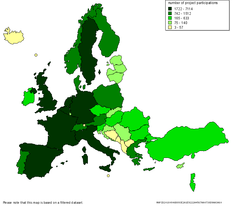
The Geographical View allows to interactively analyse the data of the monitoring system broken down by national (country) and regional (NUTS 2) level by producing maps and tables. This view analyses the whole database thus please allow a few seconds for the map to load. Click on the map to zoom into a specific country, or click on a country or region in the table to view a list of project partners and the projects in which they are participating. Please note that maps are only available for the EU-27 and the countries associated with FP7. The regional level in principle corresponds to NUTS level 2, except for Belgium, Germany and the UK, where NUTS level 1 is used instead. You can apply one or several expert filters to focus the analysis on specific areas of interest. For a video tutorial explaining the functionality and features of this View, please click on the screenshot on the right or visit the “Video tutorials” section.


